Trimble Stratus
Trimble Stratus
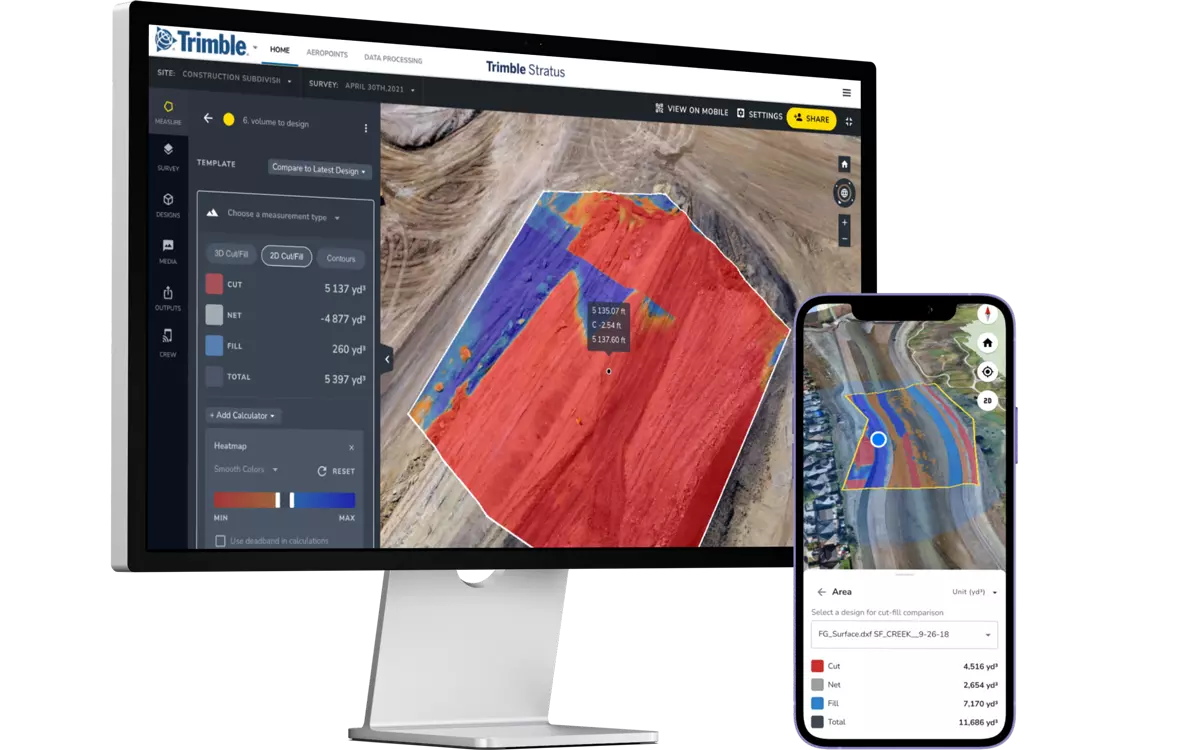
With Trimble Stratus Software, you can use drone data to map, measure, and manage your worksite and assets. Connect the right information to the right people at the right time.
Map, Measure and Manage Your Site Yourself
Get more done with a clear view of where you are and where you're headed.
Features and Benefits
Confidently Plan and Estimate
- Know what you’re quoting—conduct your own site surveys before the job begins, and whenever changes occur
- Get frequent, detailed images of site boundaries and protected areas to easily demonstrate your conformance with regulatory requirements
- Tighten plans and budgets with more frequent and accurate volume data
Survey Frequently and Faster
- Get accurate, up-to-date topographic surveys whenever you need without having to bring in a survey crew
- Avoid information bottlenecks by getting answers to questions yourself with an intuitive, web-based tool
- Survey inaccessible or hazardous areas safely using a drone
Site Volumes
- Calculate overall material volumes added or removed from pits, stockpiles, cells and drainage channels
- Measure stockpile volumes more frequently and safely to enable better stockpile management
Communicate Effectively
- Easily share progress updates with your team and customers through a centralized cloud-based workspace
- Track site changes, avoid crossed wires and resolve disputes quickly
- Fewer site visits needed when people can track progress and inspect work remotely, manage more sites more easily
Design Checks
- Upload design file to compare actual surface to design surface and track progress
- Measure remaining sitework and generate evidence of completed work
- Calculate volumes, cross-sections, and slopes against final designs
Mobile Mapping
- Contractors can use the mobile app as an extension of the Trimble Stratus platform to generate and share simple, interactive maps from the office to the field
- Field teams can explore 2D or 3D models of their site to work collaboratively, see their real-time location against designs, and measure progress
- Mobile photo capture on the app allows you and your team to pin, organize and react to media on the map
Applications
- Civil Construction
-
Applications
- Frequent and accurate data capture
- Track earthworks progress against design
- Quality assurance
- Project management
Details
- Capture survey-grade topos
- Calculate how much material you need to move and create cut fill maps
- Compare your measurements with finished grade designs or previous surveys to track progress
- Monitor site activity and communicate site conditions seamlessly from office to field
- Prevent disputes and rework with a full surface analysis
- Aggregates
-
Applications
- Monitor and manage inventory
- Manage mining and blasting operations
- Inspection of equipment and supervision of contractors
- Organization of roads and traffic
Details
- Easily compare the volumes before and after blasting and measure the angle of the blasting surface
- Calculate borehole depths using borehole surface models
- Safe inspection of explosion fragment areas
- Manage the stock volume in the pit and calculate the total volume removed from the pit using surface comparisons
- Calculate slope angles and pit angles and compare actual surface-to-model to track compliance
- Tracking of changes in the angle of inclination between measurements in order to better control possible slipping
- Enhance safety by remotely inspecting walls by geotechnical engineers
- Export of 3D DXF and point cloud files for updating pit and dump plans
- Optimize traffic management by ensuring that road grades, widths and cross slopes meet design specifications
- Reduction of cycle times and optimization of the efficiency of mobile systems by tracking the conformity of the transport routes
- Inspection of areas before and after major events such as heavy rains
- Mining
-
Applications
- Effective tracking of the status of your mine
- Measure the volume of the stockpile
- Check the road gradient
- Generate terrain maps
Details
- Upload planning areas to visually track progress based on your 3D location survey
- Compare different measurements to see changes over time
- Uncover non-compliance issues before they get expensive
- Faster, better inventory estimates
- Waste
-
Applications
- Monitor landfill progress and productivity
- Check cell volume, remaining air space and density
- Calculate current, changed and remaining airspace for EPA reporting
Details
- Increase the productive life of your cells by tracking and maximizing compaction rates over time
- Calculate cover material for operational efficiency and environmental requirements
- Improve compliance reporting and airspace management
How It Works
- Place ground control
- Fly drone over site
- Upload ground control
- Upload drone images
- Dataset is processed
- Analyze and share site maps and models
Meet Our Customers
Learn how customers around the globe are using Trimble technology to be more efficient and profitable.