Trimble Stratus Drone Software
Powered by Propeller
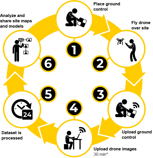
Trimble Stratus Software Powered by Propeller is designed to make worksites more manageable, efficient and accurate. Using drones to map, measure and share information. You’re able to make quicker decisions, avoid mistakes and generate more revenue.
Accuracy in Measurement
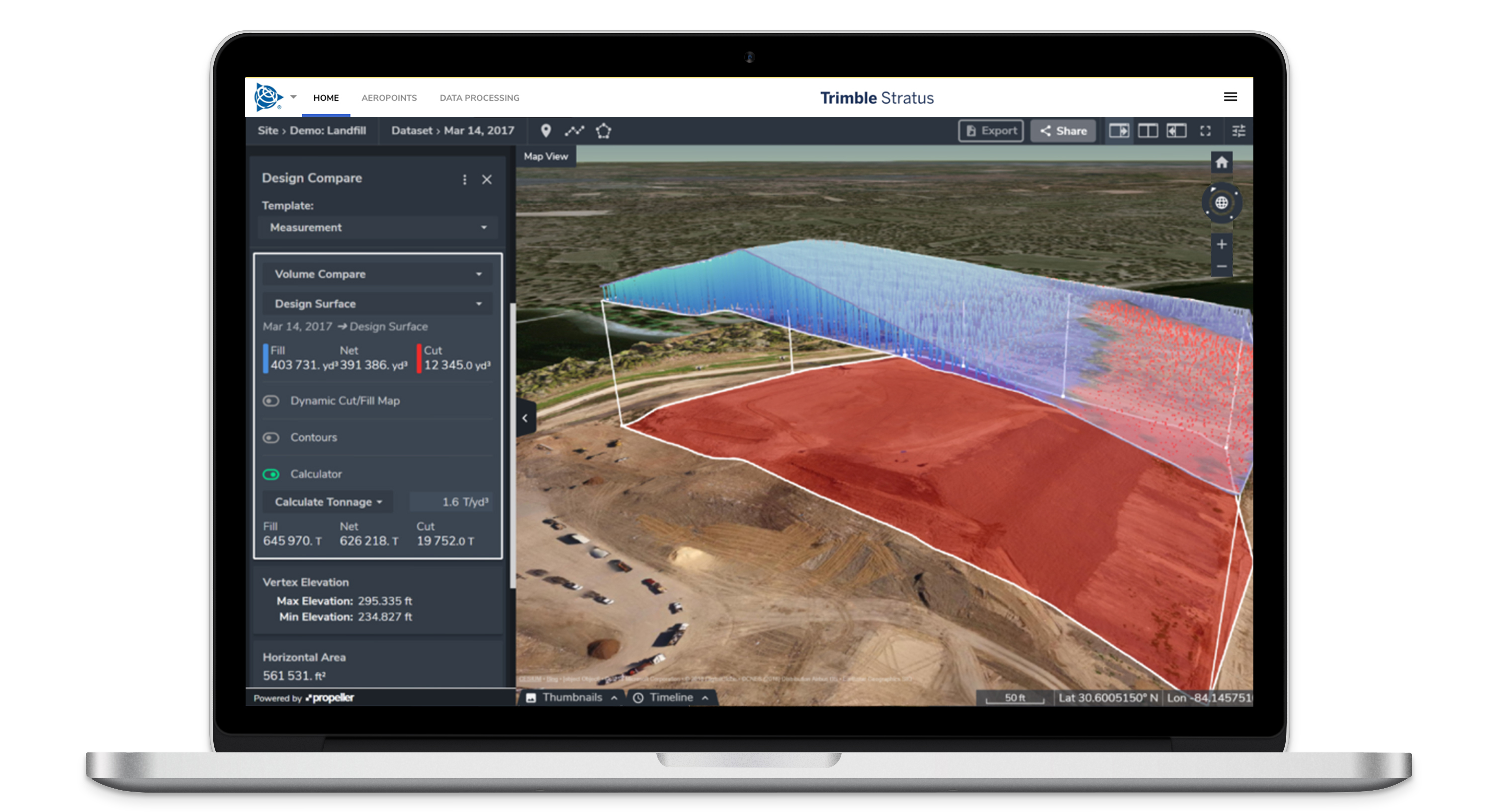
With Trimble Stratus Powered by Propeller, you will be able to map, measure and share accurate information about your worksites and machines on site, enabling you to connect the right information to the right people, and at the right time. Using a data-centric approach helps to reduce mistakes and increase revenue, providing the ability to make decisions quicker.
Being able to conduct your own site surveying is vital to accurately understanding conditions on the ground. By using drones and Trimble Stratus, you have the ability to quickly gather high-resolution geospatial images with critical survey data. This provides you with more accurate data to review when building project estimates and planning your site work.
Collaboration with shared access
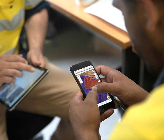
Trimble Stratus allows you to easily share progress updates with your clients through a centralized, cloud-based login system. Your data can be used with other Stratus software programs in real-time, providing an efficient and integrated solution for data management and sharing. It also allows you to quickly and easily analyze site maps and models as the data is processed and returned within hours.
Efficiency in planning and reporting
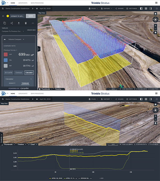
The mapping tools help improve workflows across the business and allow for smarter decision making. Your teams can instantly visualize the surfaces in 3D by logging into your company’s Trimble account. They can also create their own high-quality reports for cut and fill mapping, stockpile management and quantification, cross-section analysis, and evaluating slope heights to compare with site measurements. This means that your teams can find and share the answers they require almost immediately.
Applications
- Construction
-
Applications
- Tracking progress against the design
- Quality assurance
- Subcontractor management
Details
- Capture topos
- Create excavation and backfill maps
- Carry out quick volume calculations of moved material for contract fulfillment and payment
- Proof of location changes with a visual timeline
- Quarry
-
Applications
- Monitor and manage inventory
- Manage mining and blasting operations
- Inspection of equipment and supervision of contractors
- Organization of roads and traffic
Details
- Easily compare the volumes before and after blasting and measure the angle of the blasting surface
- Calculate borehole depths using borehole surface models
- Manage the stock volume in the pit and calculate the total volume removed from the pit using surface comparisons
- Mining
-
Applications
- Effective tracking of the status of your mine
- Measure the volume of the stockpile
- Check the road gradient
- Generate terrain maps
Details
- Upload planning areas to visually track progress based on your 3D location survey
- Compare different measurements to see changes over time
- Uncover non-compliance issues before they get expensive
- Faster, better inventory estimates
- Waste
-
Applications
- Monitor landfill progress and productivity
- Check cell volume, remaining air space and density
- Calculate current, changed and remaining airspace for EPA reporting
Details
- Increase the productive life of your cells by tracking and maximizing compaction rates over time
- Improvement of compliance reporting and airspace management